Severe Thunderstorms Possible for South Plains on Monday & Tuesday
A severe thunderstorm watch is in effect until 11 p.m. Monday for a majority of the southern Texas Panhandle, South Plains, and Rolling Plains.
Scattered to numerous thunderstorms are expected to develop across eastern New Mexico into the western and northern South Plains Monday afternoon and evening.
The National Weather Service says the main threat from these storms will be large hail up to tennis ball size and wind gusts over 65 miles per hour.
The NWS also says that a limited tornado threat will also exist as storms interact with a west to east frontal boundary across the South Plains.
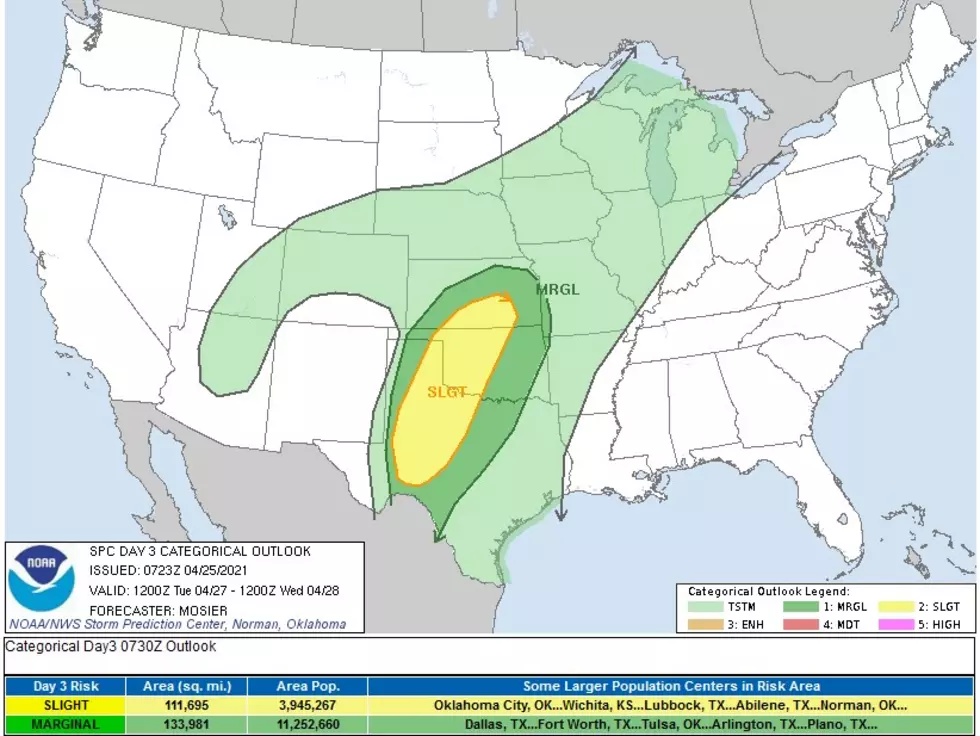
Scattered thunderstorms are also possible late Tuesday afternoon, which could have the potential for large hail and damaging winds.
As the weather changes, KFYO and Ron Roberts will bring you the latest updates.
More From News/Talk 95.1 & 790 KFYO