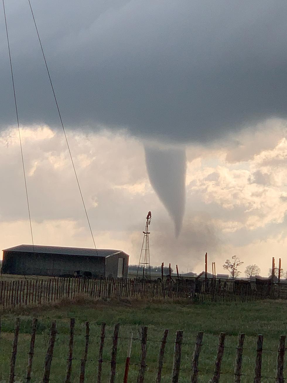
The main hazards may be winds above 60 mph, possible tornadoes and hail between 1" to 2" inches in diameter. KAMC's Ron Roberts & Rob Snyder will have the latest updates for you on KFYO.
It hasn't been that long since Texans went through a massive winter storm that knocked out power to millions across the state. Now we are in severe weather season and that means powerful storms that could produce tornados. And let's not forget that we are still in a pandemic and this time last year stores were running low on meat, toilet paper, and other goods...
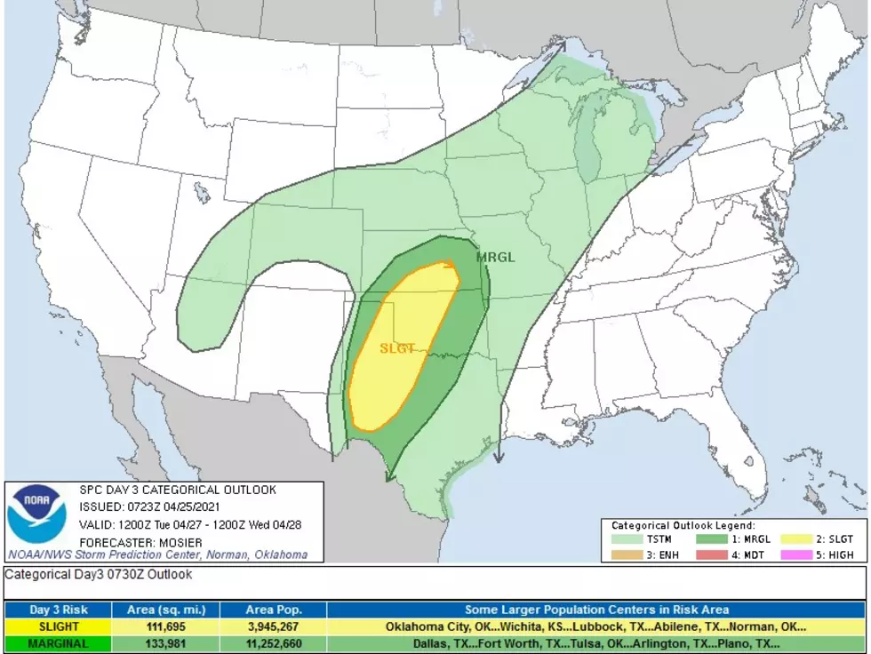
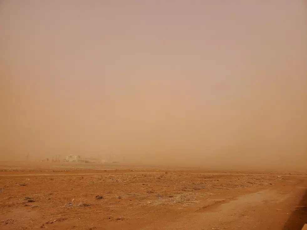
It's Spring time in Lubbock and while that means plants are blooming and grass is beginning to get greener, it also means severe weather season has arrived. In fact, we've already had a taste of severe weather this year with a tornado in the area, urban flooding, and a pretty big dust storm...
Smaller snowfall totals are expected north of Lubbock, while 5" to 6" of snow is also expected west, and south of Lubbock, including in Snyder, Lamesa and Tahoka. Travel is expected to be impacted in Lubbock all-day Sunday.
Precipitation will start Monday morning before 4 a.m., and by the time people begin their morning commutes, freezing rain and sleet is expected across the region. The winter weather will then continue through Wednesday afternoon.
Hurricane Laura is strengthening and according to the Associated Press, could become a catastrophic Category 4 Hurricane by the end of the day on Wednesday. In the storm's path sit both the Texas and Louisiana coasts and residents who are boarding up homes and businesses before evacuating...